iFlightPlanner


...

Blog

Monday, February 27, 2017

FAA Airport, Navigation & Chart Data Available for 3/2 Cycle

Monday, February 27, 2017 @ 8:00 AM

iFlightPlanner for iPad users may now download airport and navigation data as well as aeronautical charts, georeferenced airport diagrams and terminal procedures for the FAA Data Cycle that goes into effect on March 2, 2017.  Simply tap the button in the upper-left corner of the Downloads tab to "Check For Updates".

Pilots using iFlightPlanner.com or mobile.iFlightPlanner.com from their smartphones will see the iFlightPlanner Cloud automatically make the transition to the new data at 9:01Z on March 2.

Monday, February 13, 2017

FAA Calls for Heightened Awareness of Class B Airspace

Monday, February 13, 2017 @ 8:00 AM

In a Safety Alert for Operators (SAFO) bulletin issued January 29, 2017, the FAA is calling for all pilots and flightcrew operating near the boundaries of Class B airspace to exercise caution and be aware of the risk of excursions out of and incursions into Class B airspace.  According to the SAFO, all pilots and flightcrew should utilize published resources to become familiar with the vertical and lateral boundaries of Class B airspace they may be operating in or near.

For more information, see the entire SAFO here.

» iFlightPlanner's Interactive Airspace Tool

Friday, February 10, 2017

BasicMed Not Impacted By Regulatory Hold Order

Friday, February 10, 2017 @ 8:00 AM

The suspension of all new federal regulations by the incoming administration will not impact BasicMed reforms, as had been feared by some in the aviation community. The directive issued on January 20 by White House Chief of Staff Reince Priebus halts publication of new regulations until approved by an agency director appointed by the incoming administration and suspends the effectiveness of previously published regulations for 60 days.

The published effective date of the BasicMed rule, May 1, 2017, is more than 60 from the January 20 directive, which exempts BasicMed from this directive. Additionally, the directive excludes those regulations subject to statutory deadlines.

» Read More on AVweb

Wednesday, February 8, 2017

San Francisco Class B Airspace Changes Proposed

Wednesday, February 8, 2017 @ 8:00 AM

Proposed San Francisco Class B airspace changes would enable lower-angle descents into SFO optimized for the higher glide ratios of modern jet aircraft, reducing noise and fuel consumption.

“A low thrust descent in a clean configuration results in the smallest noise footprint [regardless of altitude], and a descent in a clean configuration at near idle thrust results in lower fuel burn” says Rick Cote, an ATC Specialist with Northern California TRACON (NCT).

» Read More on AVweb

Monday, February 6, 2017

Flight Advisory for Presidential Address to Congress

Monday, February 6, 2017 @ 8:00 AM

The planned 2017 Presidential Address before a Joint Session of Congress in Washington, DC is scheduled for February 28, 2017. At the request of the department of Homeland Security and as part of the airspace security measures for the event, the FAA will be modifying the Washington Special Flight Rules Area (SFRA) and Washington Metropolitan Flight Restriction Zone (FRZ) with additional flight restrictions.

The NOTAM discussed in this advisory may change with little or no notice. Pilots are advised to check NOTAMs frequently for possible changes prior to operations in the area. Pilots are strongly advised to contact a Flight Service Station at 1-800-WXBRIEF prior to flight to check for all current NOTAMS.

The FAA point of contact for the 2017 Presidential Address to a Joint Session of Congress is the National Capitol Region Coordination Center (NCRCC) at (866) 598-9522.

Friday, February 3, 2017

iFlightPlanner for UAS Operations

Friday, February 3, 2017 @ 8:00 AM

iFlightPlanner’s freely accessible aviation charts interface is the perfect resource for UAS operators to pinpoint lat/lon coordinates, identify the nearest airport, view airspace details, and prepare their description of the proposed operation when requesting a waiver and/or airspace authorization under Title 14 CFR Part 107 of the Federal Aviation Regulations (FAR).

We have created iFlightPlanner for UAS Operations (PDF) to help bridge the gap between the features of iFlightPlanner currently designed for manned flight and how they can be leveraged by unmanned operators.
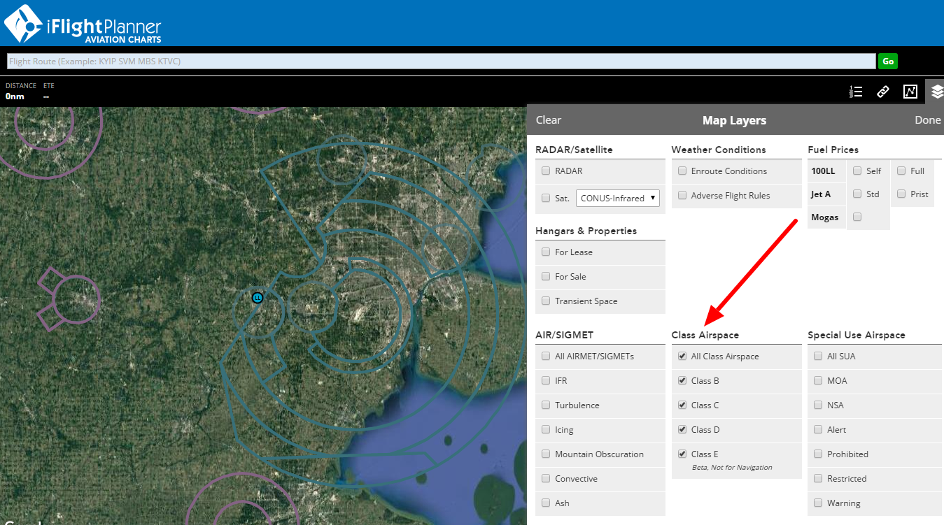
The tutorial is a step-by-step guide to gathering the information necessary to submit a waiver or authorization through the FAA DroneZone.  It's important for all operators to review the Step-by-Step Application Process, Waiver Application Instructions, and Waiver Safety Explanation Guidelines as published by the Federal Aviation Administration (FAA) before any operations.

» iFlightPlanner for UAS Operations (PDF)

If you have questions specific to planning your UAS operations with iFlightPlanner that were not covered in the tutorial, please send us a message!

The iFlightPlanner Crew
PLAN. FLY. LOG.

Thursday, February 2, 2017

FAA Airport, Navigation & Chart Data is Current for 2/2 Cycle

Thursday, February 2, 2017 @ 4:01 AM

Official airport, navigation and chart data for the FAA's 28-day cycle beginning 2/2/17 became current today as of 09:01Z.  This includes updated georeferenced data for airport diagrams and instrument approach procedures available in iFlightPlanner for iPad.

Anytime you access iFlightPlanner.com or mobile.iFlightPlanner.com you can be confident that you are seeing the most current and accurate data available.  To ensure that iFlightPlanner for iPad is current, simply tap "Check for Updates" in the upper-left corner of the Downloads tab.  The app will quickly tell you which packages need to be updated!

The iFlightPlanner Crew
PLAN. FLY. LOG.